What is a Topographical Survey?
A topographical survey is the foundation of any land-based project or design. The survey gathers spatial information on natural and man-made features such as trees, large rocks, buildings, and driveways. This data helps determine whether a project can be accomplished and what obstacles will need to be overcome.
Do I need a Topographical Survey?
Topographical surveys are often the first step in a construction or development project, providing critical data for the design and planning process. Spotting any issues at the beginning of the project helps cut costs, preventing problems further down the line. Topographical surveys are often required for the submittal of permit plans.
Topographical surveys begin with an indepth collection of information. Following that, the land surveyor will begin to produce the survey drawing back at the office. Most commonly, this will be completed within 1-2 days.
As a Hampshire based company, most of our customers are within our county and the neighboring counties. However, we have conducted work for clients all across the south and beyond.
The main purpose of a topographical survey is to gather accurate land measurements of a site’s natural and artificial land characteristics.
Those intending to develop there will have a better understanding of the state of the land and how it could affect the kind of building that might be constructed there.
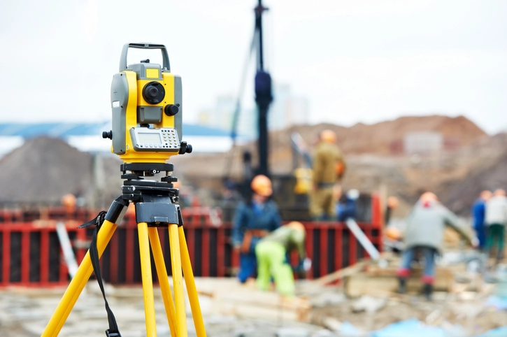
Topographical surveys are carried out by land surveyors with a variety of specialised survey tools that can measure distances and angles with exceptional accuracy.
This data is usually collected with an electric optical surveying instrument called a Total Station.
A topographical survey will gather precise measurements and data on all of the natural and artificial features of a site.
Depending on what’s required, surveys can include measurements on a range of elements such as: area boundary lines, water levels, buildings, woodland, vegetation and bushes, and much more.
If you’re interested in what else we can include in your survey then contact us using our form or give us a call on 023 8029 2076.

Health and Safety:
All of our surveyors are provided with – Construction Skills CSCS Smartcard training. We are also completely open to adapting to any site specific inductions and procedures.
Equipment:
We believe in using the best equipment available and all of our surveyors use the following Leica Geosystems instruments; Robotic Total Stations, GPS Rovers and Disto Laser Measures. This allows us to conduct highly accurate Hampshire boundary surveys.

